Monday 23 June 2014

Fun Fundy: Hopewell Rocks and the tidal bore

Okay, enough of the Fundy names already!

On the trail to see the Hopewell Rocks
Aw, just one more! Well, one more trip to see the marvels of the Bay. This time, we traveled up to upper end of the Bay to see the famous Hopewell Rocks, and watch the tidal bore on the Petitcodiac River in Moncton.


About an hour after high tide
The Hopewell Rocks are a series of flowerpot rocks in Shepody Bay, on the upper edge of the Bay of Fundy in New Brunswick. They really need to be seen at both high and low tide to get an appreciation for how these massive tides shape the earth. When the tide is in, the tops of the rocks look like islands, and the water laps against the cliff face.  


When the tide is out, there’s plenty of space around them to explore.  


Low tide

 Morgan liked kicking at the rocks, and stepping in the bits of mud.

Lily liked balancing on the rocks better. (This is the only set people are allowed to climb. The rest are off limits.) 


cliffs with mud flats in the distance
 On either end of the rocky cliffs are wide expanses of ecologically important tidal flats and beach/ marshland that support several species of shorebirds in the summer months.


Those are at least a km wide when the tide is out


People are asked not to walk on the mud, in order not to disturb the birds or their foodsource (shrimp).


The small interpretive center has interesting information about the formation of Bay of Fundy, the ecology of the region, and whales.


Another neat phenomenon of the high tides is the tidal bore which occurs on some of the rivers around the upper end of the bay. As the tide comes rushing back in (a couple hours before high tide), all that water gets funneled into the river basin, which can create a wave of ocean water moving backwards up the river bed. Sometimes this is only noticeable as a ripple, and sometimes it’s a wave large enough for people to surf on.  This is quite dependent on a number of factors, but generally the full moon makes for greater bores (due to the moon’s greater pull on the tides at this time). We were fortunate enough to be there near the full moon.
After visiting the Hopewell Rocks at low tide, in the morning, we drove into Moncton and joined the crowd waiting at Tidal Bore Park to await the arrival of the bore. Three surfers also waited, further downstream. Ten minutes later, here it came.


Nature is so cool.


Tuesday 17 June 2014

Phenomenal Fundy: St. Martins sea caves and the Fundy Trail

New Brunswick does nature (and scenery) well. Rolling countryside covered in dense forests, lakes, and rivers, and the coastline of the Bay of Fundy. So pretty. So interesting. It just begs to be explored.
A short drive north of Saint John is the small village of St. Martins. Here is a good place to get an impression of the tidal rise & fall in the Bay. At high tide the small wharf is completely full of water, with the boats floating beside the dock, and at low, is completely empty of water, with its fishing boats sitting on the ocean floor, and the ocean over a kilometer away out in the bay. Up and down goes the ocean (or in & out) day in and day out. That’s the rhythm of life here. (It’s important to know the schedule of the tides so you can also plan your sightseeing accordingly!).
St. Martins is also famous for its sea caves. The caves have been (and are being) pounded out by the continual wave action and erosion of the tides. 


They are impressive, tall, shallow caves, which can be kayaked at high tide, or walked in at low tide. 


The red rock is striated by the action of the ocean, the ceilings drip with water, and various ocean plants grow in and around them. 


Lily was enamored with the colonies of sea snails, hanging out on the rocks, waiting for the tide to come back in. 


Bob and Morgan went around the corner to check out more caves, while Lily rearranged the snails into groups (I bet they were confused when they poked out of their shells!). 


The kids also both found the mud, although it’s really hard to avoid it here. (I really, really need to start bringing a change of clothes for both of them, everywhere.)  The caves were big and impressive, and interesting, but I like the cave Morgan and I found earlier in the day, on the Fundy Trail.

Up the road from the sea caves, is the Fundy Trail, an 16 km multi-use (user pay) trail that treks along the unspoiled coastline. The trail winds through forest, to cliff tops with overlooks of the Bay, down to beaches, over rivers, and provides information about the plants & animals that make this region home. 
Much of it is easy walking, but some sections are quite steep. The well paved road runs nearby the trail, but the two intersect only once in a while. (So, in case you go on a walk down the trail, it’s good to note how far back you might have to walk to get your vehicle!).
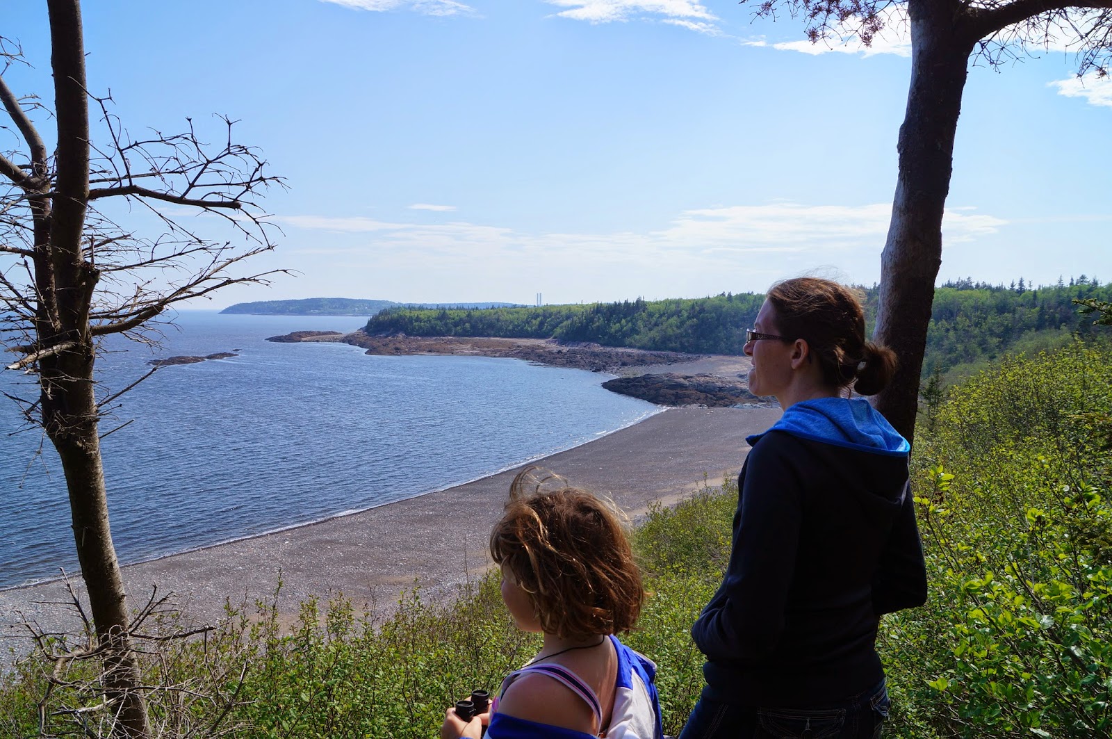
We decided to walk along the Flowerpot scenic trail, which is an easy trail down the hill, to an overlook of a flowerpot rock (a column of rock with plants/ trees on top, that is generally surrounded by water at high tide), and then through the forest. 


The trail continues for a bit over a kilometer, until it splits – either to loop back up to the starting point, or down to a beach. Bob and Lily went on the loop back to get the truck, while Morgan and I walked down to the beach. I think we got the better end of the deal. 


The trail was quite steep, but the beach at the end was amazing. Two small streams descended the hill, onto opposite ends of the beach. They each flowed down their channels, and disappeared under mounds of gravel, only to reappear further down the beach. 


Large mounds of smooth gravel testified to the power of the waves here. 


On the one corner of the beach was a gravel filled sea cave, 


the high water mark extremely obvious. 


Several types of stone were evident inside the cave – smooth sedimentary rock, which fell off in strips, and a red conglomerate rock, with other rocks embedded.


The gravel near the sea cave crunched hollowly underfoot. It was very loud sounding, and very eerie. Was it really hollow underneath (the mounds further away didn't sound like that)? Ah well, a mystery for another day.
There was quite a bit more beach past the sea cave, but I knew that Bob and Lily would be waiting (and it would take us a few minutes to climb that hill!). 
After rejoining the rest of the family, we continued driving along the trail, stopping at various overlooks and eventually arriving at the Interpretive Center beside the Big Salmon River. 


A traditional hatching river for Atlantic salmon, for years there were no salmon in this river. They seem to be making a comeback, though and we were told that the smelts had been spotted making their way out to sea. We didn't see any though. I guess that leaves me fishless in Fundy. 

The road continues on up past the river, to overlook the cliffs for a ways, until the road ends, and you have to turn around. The trail is a work in progress, and is slowly being extended north to open up even more spectacular scenery to the public eye.


This was a great day trip, but boy were we tired at the end of it! Maybe we’ll take a day off before exploring more nature…

Monday 16 June 2014

Fantastic Fundy: Irving Nature Park and the Reversing Falls

The Bay of Fundy has the highest tides in the world; up to 50 feet in places. That’s taller than a four story building.  At Saint John, where we spent a week, the tides are closer to 25-35 feet. If you have a two story house, go outside and look at it. Imagine that every 12 and a half hours, or so, it was completely covered with water, and six hours after that the water is all gone. That’s the tide here. It’s really impressive, and makes for some spectacular sights up and down the coast.
Irving Nature Park, on the southern edge of Saint John, is a great place to see the tides, and experience the Bay, without having to travel far from the city. The park sits on a piece of land that juts out into the Bay of Fundy, starting as the rolling hills (which seem to be a staple of New Brunswick landscape) let out onto marshland and a gravel beach that slopes down to the Bay. Past this flat area, the land rises again onto a spur of higher, rocky ground that was left by the glaciers long, long ago.  

At high tide, the spur would be mostly surrounded by water – mudflats on one side, and the Bay on the other. We were there at low tide, and so the mudflats were nearly drained, and the main gravel beach was very deep. Lines of seaweed indicated that at high tide the beach would hardly be there at all.


Multiple walking trails, as well as a one way road provide access to nearly the entire spur, which is covered in dense forest, little streamlets, and of course, views of the ocean. The main trail (Heron) which runs parallel to the road (and shoreline) provides fantastic views of the mudflats and bay, while the inner trails offer insight into the flora and fauna found within the park. The road & Heron trail both let out onto multiple beaches. 

 At low tide, each beach offers something slightly different to explore. This one had a stream running through it, that one full of perfectly smooth stones, and another one is filled with colorful sea snails waiting for the tide to come back in.

The beaches on the mudflat side were different from the beaches on the Bay side – likely due to the difference in water flow (The mudflat side would be subjected to much less pounding surf, and the beach stones and outcroppings were rougher. They were also muddier!).


We took the truck around the road, stopping at the parking areas, or the small pull outs to walk down to beaches, or explore sections of the trail (inner and outer ones). 


The kids eventually tired of walking, and so the adults took it in turns – one to walk the trail, with or without a kid in tow, while the other drove to the next parking area. This worked well, as we each got to enjoy a part of the trail, without having everyone walk the long loop (or keep going back for the truck).  


The park seems to be a favourite with locals, as there were many people out walking and jogging the trails. And, really, who wouldn't want to frequent there, with such natural beauty and ever changing scenery to enjoy?


Also, while in Saint John we went to see the Reversing Falls. Reversing rapids, really, but it is a neat place to see the influence of the massive tides. The Saint John River lets out into the Bay of Fundy – half the time. The other half, the ocean water is surging back upstream, and the river actually is being pushed backwards. We took a look at both low and high tides. 


At low tide, the river was flowing to the ocean, and many whirlpools were visible at the bend in the river, where the level of the river drops (visibly decreases in altitude). 


A little further upstream, kayakers were having fun in the rapids near a small set of islands. 


Lily sat on the railing, and watched people fish on the rocks below.
The following day, at high tide, indeed, the water was noticeably going the other way! 


The big rocks at the bend in the river were submerged (no whirlpools), and upstream where we had watched the kayakers , there was no evidence of rapids around the islands. The rocks, where the people had been fishing were at least 15 feet under water. 


Further beyond that, you could see the rapids where the ocean water and river water met, by a change in water color, and an ever moving line of white water. 

Nature is awesome!